
Exploring Portland’s Extinct Volcanoes
Here's where to hike, picnic and play on four extinct Portland volcanoes.

Matt Wastradowski
Matt Wastradowski is an Oregon-based travel writer who loves writing about the great outdoors, craft beer, and regional history.
Portland is a city of many nicknames: Around town, you might hear it called Stumptown, Rip City or even Soccer City USA. But Scott Burns, professor emeritus of geology at Portland State University, has another suggestion: “Portland is known as the City of Roses, but I think it should be called the City of Volcanoes,” he says. “Because we are the only major city in the lower 48 states with a volcano inside the city limits.”
In fact, Portland has several extinct volcanoes within city limits — as do Cedar Hills, Oregon City and other nearby communities. And in many cases, these extinct volcanoes have become part of the fabric of recreation in Portland — hosting some of the city’s best sunset views, basketball courts, hiking trails and other outdoor opportunities. Here’s a look at how it all happened — and where you can explore four extinct Portland volcanoes today.
How Does Portland Have Extinct Volcanoes?
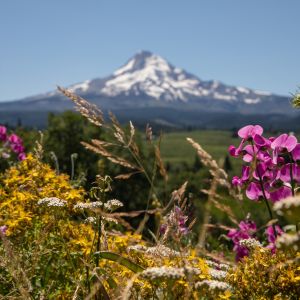
Mount Hood sits about 50 miles (80 km) east of Portland and is undoubtedly the most famous volcano in the region. But more than 20 extinct volcanoes dot the broader Portland metro area and provide ample opportunities for outdoor recreation.
All those Portland volcanoes are part of what’s called the Boring Volcanic Field — named for the Portland suburb of Boring, Oregon, and not the lack of enthusiasm around its existence.
In all, the Boring Volcanic Field comprises more than 80 buttes, lava flows, cinder cones, vents and other volcanic features across northwest Oregon and southwest Washington — stretching roughly from the city of Beaverton in the west to the Columbia River Gorge in the east, and from Oregon City in the south to Vancouver in the north. The field’s volcanic activity began roughly 2.5 million years ago near Oregon City and continued until about 57,000 years ago — when the youngest of the field’s volcanoes, Beacon Rock, erupted in the Columbia River Gorge.
All of the volcanoes within the Boring Volcanic Field are extinct … Of the 80 or so volcanic features, Portland is home to four — all of which have become popular recreation centers around the city.
How did the volcanic field form — and why? Burns says scientists are still trying to figure that out. All of the volcanoes within the Boring Volcanic Field are extinct — meaning none are at risk of eruption anytime soon. Of the 80 or so volcanic features, Portland is home to four — all of which have become popular recreation centers around the city.
Portland’s Extinct Volcanoes
Outdoor Opportunities Abound All Over Mount Tabor
Mt. Tabor Park has been a Portland icon since the city’s earliest days, when a pair of reservoirs at its base were installed to provide the community’s drinking water. In 1909, Portland acquired the land on Mount Tabor, an extinct cinder cone that rises more than 600 feet (182 m), for a park that remains bustling more than a century later. (Fun fact: City officials didn’t know Mount Tabor was a volcano until 1912 — three years after they purchased the land for a park.)
Today, visitors can ascend Mount Tabor’s forested slopes via a handful of signed hiking trails, enjoy sunset views of the downtown skyline from several picnic sites, let Fido run free in an off-leash dog area, frolic in a children’s playground and even play basketball on a court surrounded by towering Douglas fir trees. A short walk from the court is a display that showcases a rocky cinder cone that sat at the heart of Mount Tabor before eventually breaking through to the surface; other volcanic cinders were used in the early 1900s to pave the park’s roads.
Sweeping Views Common From Atop Rocky Butte
At about 92,000 years old, Rocky Butte is the youngest of the four Boring Volcanic Field volcanoes in Portland proper. The extinct cinder cone sits where Interstate 205 and Interstate 84 meet in East Portland, offering 360-degree views from Joseph Wood Hill Park atop its wide-open summit. (Local’s tip: though the small park at the butte’s summit is called Joseph Wood Hill Park, Portlanders generally refer to the whole area — the park, the surrounding grassy areas and the nearby slopes — as simply “Rocky Butte.”)
Know Before You Go
The gate into Joseph Wood Hill Park is closed May–October to prevent vehicle access to the loop just below the summit of Rocky Butte; please respect all closures, and park only in designated areas.
The grassy field at its peak, part of the broader Rocky Butte Natural Area, makes a fine place to enjoy a picnic — not to mention bask in views of Mount Hood and Mount St. Helens rising above the horizon, planes taking off from nearby Portland International Airport, and dramatic sunrises and sunsets on clear days. Its forested slopes, meanwhile, host a few hiking trails and a craggy rock face popular among experienced climbers.
Powell Butte a Natural Oasis in the Midst of the City
Much of what makes Portland so special — like scenic vistas and urban escapes into nature — can be found at Powell Butte Nature Park in East Portland.
The 610-acre (246 ha) park sits atop (and around) an extinct cinder cone near the headwaters of Johnson Creek. More than 9 miles (14 km) of multi-use trails (many of which are paved for users of all abilities) crisscross the park and showcase a variety of ecosystems — including open meadows, quiet wetlands and groves of western red cedar and wild hawthorn. Keep an eye out for some of Powell Butte’s resident wildlife, such as rabbits, gray foxes, bats, coyotes, black-tailed deer and roughly a dozen species of butterfly. On a clear day, you might spy Mount Hood, Mount Jefferson and other Cascade peaks from the summit of Powell Butte.
More Portland Hikes
The Portland region is full of excellent places for an outdoor adventure.
Kelly Butte Offers Quiet, Forested Experience
In Southeast Portland, just north of Southeast Powell Boulevard, sits Kelly Butte Natural Area — which has served the city in myriad ways for more than a century. Over the years, Kelly Butte has been the site of a firing range, quarry, jail, hospital and (in the 1950s and 1960s) a Cold War-era civilian defense center that was constructed as headquarters for local government officials in the event of a nuclear attack.
The defense center was sealed off for good in 2006, and today the 23-acre (9-ha) Kelly Butte Natural Area hosts a few short hiking trails that pass occasional viewpoints of Mount Hood’s iconic peak through stands of Douglas fir, springtime wildflowers (including the three-petaled trillium flower) and a colorful mix of vine maple and bigleaf maple — both of which turn vibrant shades of red, orange and yellow every October.
Portland Region
Don’t stop now — continue your outdoor adventures beyond the city.
Region
From mountain to ocean and desserts to valleys, the region surrounding Portland offers endless adventure.
What to Do in the Columbia River Gorge
Just 30 miles (48 km) east of Portland sits the Columbia River Gorge — a rugged canyon on the broad Columbia River and home to more than 90 waterfalls, countless hiking trails, plenty of water sports and several charming communities.
What to Do on Mount Hood
Explore Mt. Hood — the tallest peak in Oregon — with this in-depth guide that covers weather, what to pack, where to stay, outdoor recreation and how to have an unforgettable experience.
Was this page helpful?
